
Mastering Boating Navigation: Essential Tips and Tools for Safe and Confident Cruising
Nicholas HeislerShare this article
Whether you're a seasoned mariner or just getting your feet wet, understanding boating navigation is essential for safe and enjoyable time on the water. Good navigation skills can mean the difference between a smooth day on the water and an emergency situation. While GPS and other modern tools have made navigating more accessible, there's still no substitute for a well-rounded knowledge of both traditional and electronic techniques.
In this guide, we’ll break down the must-know elements of boating navigation—everything from reading nautical charts and understanding buoys to planning a safe route and using marine GPS systems. Let’s dive in and help you become the confident, capable captain your crew can count on.
1. Understanding Nautical Charts
Nautical charts are the foundation of safe boating navigation. Think of them as the water-based version of road maps, but with added complexity and detail.
Why They Matter:
Nautical charts show water depths, underwater hazards, navigational aids, coastlines, and harbor details—everything you need to plot and follow a safe course.
How to Read a Chart:
-
Depth Contours: These lines show changes in depth. Shaded areas often indicate shallow waters.
-
Soundings: These numbers indicate water depth, typically in feet or meters.
-
Symbols and Abbreviations: Rocks, wrecks, buoys, and beacons are marked using standard symbols.
-
Latitude and Longitude: Use these to pinpoint your exact location.
Pro Tip: Always use up-to-date charts, whether paper or electronic. Waterways can change due to storms, dredging, or construction.
2. Navigational Aids: Buoys, Beacons, and Markers
Navigational aids help you understand your position and avoid hazards. They’re maintained by authorities like the U.S. Coast Guard and follow standardized systems.
The IALA System B (used in North America):
-
Red Right Returning: When coming back into a harbor or heading upstream, keep red buoys (with even numbers) on your starboard (right) side and green buoys (with odd numbers) on your port (left).
-
Lateral Markers: Indicate the edges of channels.
-
Safe Water Markers: Red and white striped; show safe water all around.
- Special Purpose Buoys: Yellow buoys often indicate fishing zones, swimming areas, or cables.
- Daymarks and Beacons:These are fixed aids—like signs on land or posts in the water—used for visual navigation.
Learning to interpret these aids quickly and accurately is key to staying within safe channels and avoiding collisions or groundings. Check out our blog about how to safely pass a fishing boat on the water for more information.
3. Traditional Navigation Techniques
Even in the age of GPS, traditional navigation skills are invaluable—especially when electronics fail.
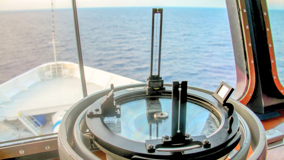
Magnetic Compass Navigation:
-
Reliable and battery-free.
-
Learn to correct for variation (difference between magnetic north and true north) and deviation (errors caused by your boat’s metal components).
-
Practice taking bearings to landmarks to stay oriented.
Dead Reckoning:
-
This method estimates your position using a known starting point, your heading, speed, and elapsed time.
-
Great for short-term planning, especially when visibility is poor.
-
It assumes straight-line travel and doesn’t account for wind, current, or drift—so use with caution.
Piloting:
-
Uses visible landmarks, buoys, and depth readings to guide your route.
-
Best for coastal cruising and short-range trips.
-
Always keep track of where you are on your chart and cross-check often.
Traditional Tools to Have Onboard:
-
Dividers and parallel rulers for chart plotting.
-
Handheld compass.
-
Notebook for keeping log entries.
4. Modern Electronic Navigation Tools
Today’s boating tech is impressive, but it’s most effective when you understand how to use it properly.
Marine GPS & Chartplotters:
-
Shows real-time location overlaid on a digital nautical chart.
-
Allows you to set waypoints and route plans.
-
Some models integrate radar and AIS (Automatic Identification Systems) for enhanced situational awareness.
Fish Finders and Depth Sounders:
-
While mainly used for fishing, these devices also help detect bottom contours and shallow areas.
-
Avoid running aground by checking water depth regularly.
Marine Navigation Apps:
Popular apps like Navionics, iNavX, and Aqua Map offer
- Offline chart storage.
-
Route planning with tide and current overlays.
-
Integration with GPS and other onboard electronics.
Don’t Rely on One System:
Use multiple tools together. Redundancy is your best defense if something fails.
5. Navigation Rules and Regulations (COLREGS)
Safe navigation isn’t just about knowing where you are—it’s also about knowing how to behave around other vessels.
Basic “Rules of the Road” for Boaters:
-
Give Way vs. Stand-On Vessel: The stand-on vessel maintains course and speed; the give-way vessel alters course to avoid a collision.
-
Crossing Situations: If another boat is to your starboard (right), they have the right of way.
-
Head-On: Both vessels should alter course to starboard.
-
Overtaking: The vessel overtaking must keep clear.
Other Navigation Must-Knows:
-
Navigation Lights: Required from sunset to sunrise and in limited visibility.
-
Sound Signals: Used to alert other boats of your actions—especially in fog or when maneuvering.
Familiarity with the International Regulations for Preventing Collisions at Sea (COLREGS) is not optional. It's critical for avoiding accidents and staying legal.
6. Planning and Executing a Safe Voyage
Before every trip, plan like a pro.
Pre-Departure Checklist:
-
Check weather forecasts and marine advisories.
-
Review charts and identify hazards along your route.
-
Plot your intended course and note contingency stops.
Tides and Currents:
-
Know when and where tides will rise and fall.
-
Understand how currents might alter your speed and direction.
Create a Float Plan:
-
Share your plan with someone onshore.
-
Include your destination, estimated arrival time, number of people aboard, and contact information.
Monitor Conditions Continuously:
-
Watch for shifting weather patterns.
-
Be ready to turn back or adjust your plan if needed.
-
Trust your instincts—if something feels off, it probably is.
7. Practical Tips for Enhancing Navigational Skills
Like any skill, navigation improves with regular use and study.
Practice Often:
-
Simulate scenarios with paper charts at home.
-
Turn off your chartplotter for short distances and use traditional methods.
Take a Boating Course:
-
Many U.S. states require a boating safety certificate.
-
Organizations like the U.S. Power Squadrons and U.S. Coast Guard Auxiliary offer navigation-specific courses.
Keep a Navigation Log:
-
Note positions, bearings, weather, and events.
-
Useful for learning and troubleshooting.
Stay Informed:
-
Subscribe to Notices to Mariners.
-
Join local boating clubs and communities.
-
Follow boating safety blogs and forums for updates and insights.
Boating With Confidence in Your Navigational Systems
Mastering boating navigation is about more than reading a chart or plugging in GPS coordinates—it’s about building confidence, developing situational awareness, and preparing for the unexpected. Whether you’re cruising the coastline or crossing a lake, the ability to navigate safely will transform your time on the water from good to great.
As a boater, your number one job is to ensure a safe trip for everyone aboard. By combining traditional knowledge with modern tools, staying informed, and practicing regularly, you’ll be well-equipped to handle whatever comes your way.
Fair winds and following seas—may your courses be true and your destinations rewarding.
When it comes to keeping your boat maintained, look to Captains Preferred Products' boat cleaners and chemicals. Find everything you need to keep your vessel in top shape—all season long.


